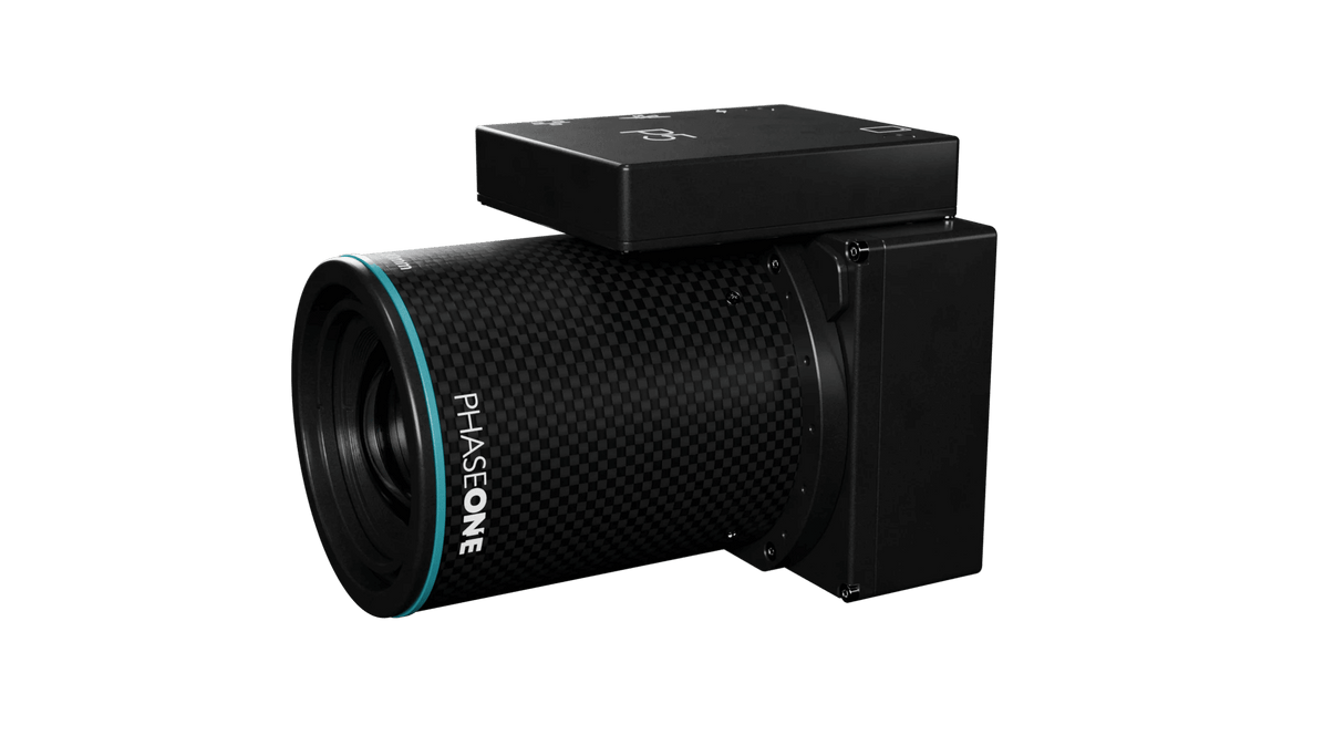
P5 Survey Payload for UAVs: Precision Engineered for Aerial Surveying Excellence
Revolutionizing Drone-based Surveying
Introducing the P5 Survey Payload, the new benchmark in high-accuracy engineering surveying tailored for UAV applications. Designed with the future in mind, the P5 payload offers a breakthrough in aerial surveying technology, making it an indispensable tool for modern surveyors.

Lightweight, Compact, and Efficient
The P5 is purpose-built to complement UAVs perfectly, featuring a compact and lightweight design, weighing less than 700 grams. It is power-efficient and ideally suited for both mini fixed and transitional UAVs, ensuring ease of use and superior portability.
Technologically Advanced for Unmatched Accuracy
Equipped with flexible mounting options, the P5 caters to both land and corridor surveying. Its advanced 1 G interface and compatibility with MAVLink/Auterion communication protocols streamline integration with UAV OEMs, providing top-of-the-line performance and convenience.
Key Features:
High Precision Metrics: Achieve exceptional survey precision with metric calibration and options for 35 mm and 80 mm lenses. The P5 offers an astounding 0.5 cm accuracy, ensuring that every measurement counts.
Advanced Imaging System: With a 128 MP image sensor, the P5 ensures low Ground Sample Distance (GSD) and crisp, blur-free images under any flight conditions. The electronic global shutter enhances image capture at high speeds, maintaining quality and detail.
Robust Data Integrity: Meticulously calibrated to eliminate geometric distortion and equipped with mid-exposure triggering to guarantee accurate capture timestamps.
Proven Performance
The P5 payload has been rigorously tested at the UAS Denmark Test Center aboard the Trinity™Pro drone throughout 2023, demonstrating unmatched reliability and performance in real-world conditions.
Integration with Industry Leaders
Quantum Systems Trinity Pro: Enhance your mapping capabilities with the Trinity Pro, a reliable and adaptable mapping solution equipped with the latest in autopilot and mission computing technology.
Trimble® Business Center: Easily transform field data into actionable insights and high-quality deliverables with TBC software, making it easier to manage data from GNSS receivers, drones, and other survey equipment.
Elevate Your Surveying Projects
Step into the future of surveying with the P5 payload. Experience the unparalleled power of precision and performance with every mission. Whether for engineering, construction, or environmental monitoring, the P5 delivers superior results, empowering professionals to make informed decisions faster.
Discover P5 — Where Engineering Precision Meets Aerial Innovation
Elevate your aerial surveying game with the P5 payload. Embrace unmatched accuracy and revolutionize your surveying projects. Start with P5 and experience precision like never before.
Payment & Security
Payment methods
Your payment information is processed securely. We do not store credit card details nor have access to your credit card information.


