
Ingeniería y Construcción
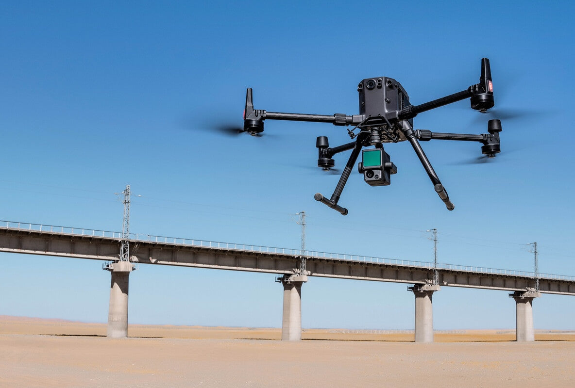
El uso de drones para levantamientos aéreos puede ser más rentable que los métodos de levantamiento tradicionales, especialmente cuando se trata de inspeccionar áreas grandes o inaccesibles. Reduce la necesidad de equipos costosos, reduce los requisitos de mano de obra y acelera el proceso de recopilación de datos.

Modelado de ciudades
Los drones pueden cubrir grandes áreas de forma rápida y eficiente. Con modos de vuelo autónomos y rutas de vuelo preprogramadas. Vuele en un patrón de cuadrícula sistemático, lo que garantiza una cobertura completa y crea diseños precisos en 2D y 3D.

Gestión de recursos naturales
Los estudios aéreos con drones proporcionan imágenes detalladas de paisajes y terrenos. Estos datos ayudan en la planificación del uso del suelo, identificando áreas adecuadas para fines agrícolas, de desarrollo urbano o de conservación.