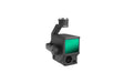
InfinitDrones Now Offers Financing

DJI Zenmuse L1

$11,619.00 CAD $17,835.00

Shield

Zenmuse L1: A Paradigm of Precision and Efficiency

Integrating a Livox Lidar module, high-accuracy IMU, and a 1-inch CMOS camera on a 3-axis stabilized gimbal, the Zenmuse L1, when paired with Matrice 300 RTK and DJI Terra, provides a comprehensive solution delivering real-time 3D data, capturing intricate details of complex structures and ensuring high-accuracy model reconstruction.

Seamless Compatibility

Matrice 300 RTK
Matrice 350 RTK (Payload requires an update)

Elevating Aerial Surveying to New Heights
  • Integrates a Lidar module, an RGB camera, and a high-accuracy IMU
  • Covers up to 2 km² in a single flight [1], ensuring high efficiency
  • Vertical Accuracy: 5 cm / Horizontal Accuracy: 10 cm [2]
  • Impressive Point Rate: 240,000 pts/s
  • Supports 3 Returns [3]
  • Detection Range: 450 m (80% reflectivity, 0 klx)
  • IP44 Ingress Protection Level ensures durability
  • Point Cloud LiveView for real-time insights


Digitize Without Compromise: Exceptional Efficiency and Unparalleled Accuracy
Create true-color point cloud models in real-time or acquire extensive data across 2 km² in a single flight. Render centimeter-accurate reconstructions effortlessly, leveraging the high-accuracy IMU, vision sensor, and GNSS data integration. Operate in diverse weather conditions with confidence thanks to the IP44 rating, and fly at night with the active scanning method of the Lidar module.
Visualize Data as You Fly: Livox Lidar Module and RGB Camera
  • Frame Lidar ensures up to 100% effective point cloud results
  • RGB Camera: 20MP, 1-inch CMOS, with a Mechanical Shutter
  • High-Accuracy IMU: 0.025° (roll/pitch) / 0.08° (yaw) accuracy, complemented by a vision sensor and data fusion capabilities


Recreate the World in 3D Point Clouds
Gain immediate onsite insights with real-time point clouds, verify fieldwork quality instantly, and utilize measurement and annotation tools for comprehensive analysis.
One-Stop Post-Processing with DJI Terra
Effortlessly generate reconstructed models and accuracy reports, as DJI Terra seamlessly fuses IMU and GNSS data, conducting POS data calculations and more.
Application Scenarios: Versatility Across Industries
From topographic mapping, AEC, and surveying, to emergency response, law enforcement, and infrastructure management—unlock a new dimension of capabilities across diverse fields, including agriculture and forestry management.

Payment & Security

Payment methods

  • American Express
  • Apple Pay
  • Diners Club
  • Discover
  • Google Pay
  • Mastercard
  • PayPal
  • Shop Pay
  • Visa

Your payment information is processed securely. We do not store credit card details nor have access to your credit card information.

DJI DJI Zenmuse L1
DJI

DJI Zenmuse L1

From $11,619.00 CAD $17,835.00

Zenmuse L1: A Paradigm of Precision and Efficiency

Integrating a Livox Lidar module, high-accuracy IMU, and a 1-inch CMOS camera on a 3-axis stabilized gimbal, the Zenmuse L1, when paired with Matrice 300 RTK and DJI Terra, provides a comprehensive solution delivering real-time 3D data, capturing intricate details of complex structures and ensuring high-accuracy model reconstruction.

Seamless Compatibility

Matrice 300 RTK
Matrice 350 RTK (Payload requires an update)

Elevating Aerial Surveying to New Heights
  • Integrates a Lidar module, an RGB camera, and a high-accuracy IMU
  • Covers up to 2 km² in a single flight [1], ensuring high efficiency
  • Vertical Accuracy: 5 cm / Horizontal Accuracy: 10 cm [2]
  • Impressive Point Rate: 240,000 pts/s
  • Supports 3 Returns [3]
  • Detection Range: 450 m (80% reflectivity, 0 klx)
  • IP44 Ingress Protection Level ensures durability
  • Point Cloud LiveView for real-time insights


Digitize Without Compromise: Exceptional Efficiency and Unparalleled Accuracy
Create true-color point cloud models in real-time or acquire extensive data across 2 km² in a single flight. Render centimeter-accurate reconstructions effortlessly, leveraging the high-accuracy IMU, vision sensor, and GNSS data integration. Operate in diverse weather conditions with confidence thanks to the IP44 rating, and fly at night with the active scanning method of the Lidar module.
Visualize Data as You Fly: Livox Lidar Module and RGB Camera
  • Frame Lidar ensures up to 100% effective point cloud results
  • RGB Camera: 20MP, 1-inch CMOS, with a Mechanical Shutter
  • High-Accuracy IMU: 0.025° (roll/pitch) / 0.08° (yaw) accuracy, complemented by a vision sensor and data fusion capabilities


Recreate the World in 3D Point Clouds
Gain immediate onsite insights with real-time point clouds, verify fieldwork quality instantly, and utilize measurement and annotation tools for comprehensive analysis.
One-Stop Post-Processing with DJI Terra
Effortlessly generate reconstructed models and accuracy reports, as DJI Terra seamlessly fuses IMU and GNSS data, conducting POS data calculations and more.
Application Scenarios: Versatility Across Industries
From topographic mapping, AEC, and surveying, to emergency response, law enforcement, and infrastructure management—unlock a new dimension of capabilities across diverse fields, including agriculture and forestry management.

Shield

  • Shield Basic
  • Shield Plus
View product